how to import google satellite maps in Smart Program?
Google satellite data is not available in WMS format, which is the only online map-data service SMART supports (along with various local-file type support). Google is only available as an XYZ tile-type server, which we don’t have direct support for in SMART at the moment:
Another option is to follow the instruction in that link above, loading Google satellite data into QGis ( a separate, free software tool for GIS data etc), then zoom to the area you are interested in, and run “Project”->“Import/export”->“Export map to Image”
And keep all the default settings on that export, which result in a georeferenced-png file that you can then add to your SMART map. You may need to make a number of exports in a grid pattern to get the level of detail you are interested in, maybe a 3x3 grid of your QGIS screen will get you decent resolution and you can therefore export 9 png files and load them all into SMART. I’m not an export on the Google imagery terms of conditions, check yourself to be sure, but I believe you are definetly not allowed to use those types of exports in another product or service you are selling, but it may be OK to use them in SMART Mobile and SMART desktop for your own analysis and internal use.
Hi There,
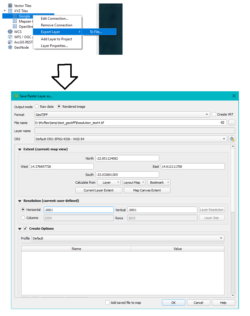
I was able to play around with this some more. I managed to get an exported image from Qgis properly geo-located in western Namibia where roads seems to line up with the coastal city roads. I ended up using the export layer option:
-setting the CRA to 4326
-press the “Map Canvase Extent” button
- and, critically, change “Resolution” section, put in very small numbers (depends how zoomed in you are), 0.001 → 0.0001 sort of thing (its decimal degrees/pixel for 4326) until the “columns” below show you a reasonable number, something like 2000-ish:
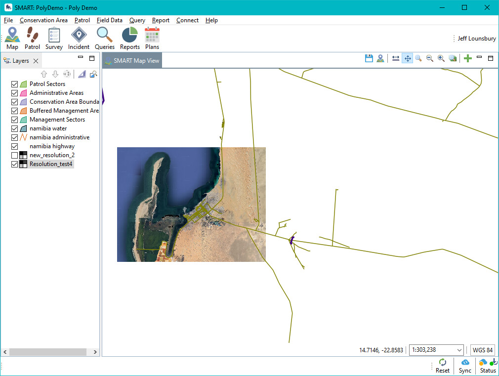
and it seems to match up to my 4326-based projection data:
just curious - where in the sources would one add a plugin that could handle modern/tiled imagery sources?
was looking at:
http://udig.refractions.net/files/tutorials/ToolPluginTutorial.pdf
and Jody’s uDig stuff: