HI all, and Justin especially!
I greet the current improvement in the functionality of SMART Mobile! The possibility to add offline maps by users of mobile app is great! The possibility of zooming to and rearranging the order of all maps: WMS online maps, user added maps and SMART map(s) is very useful as well! Now comes the inevitable “but”  !
!
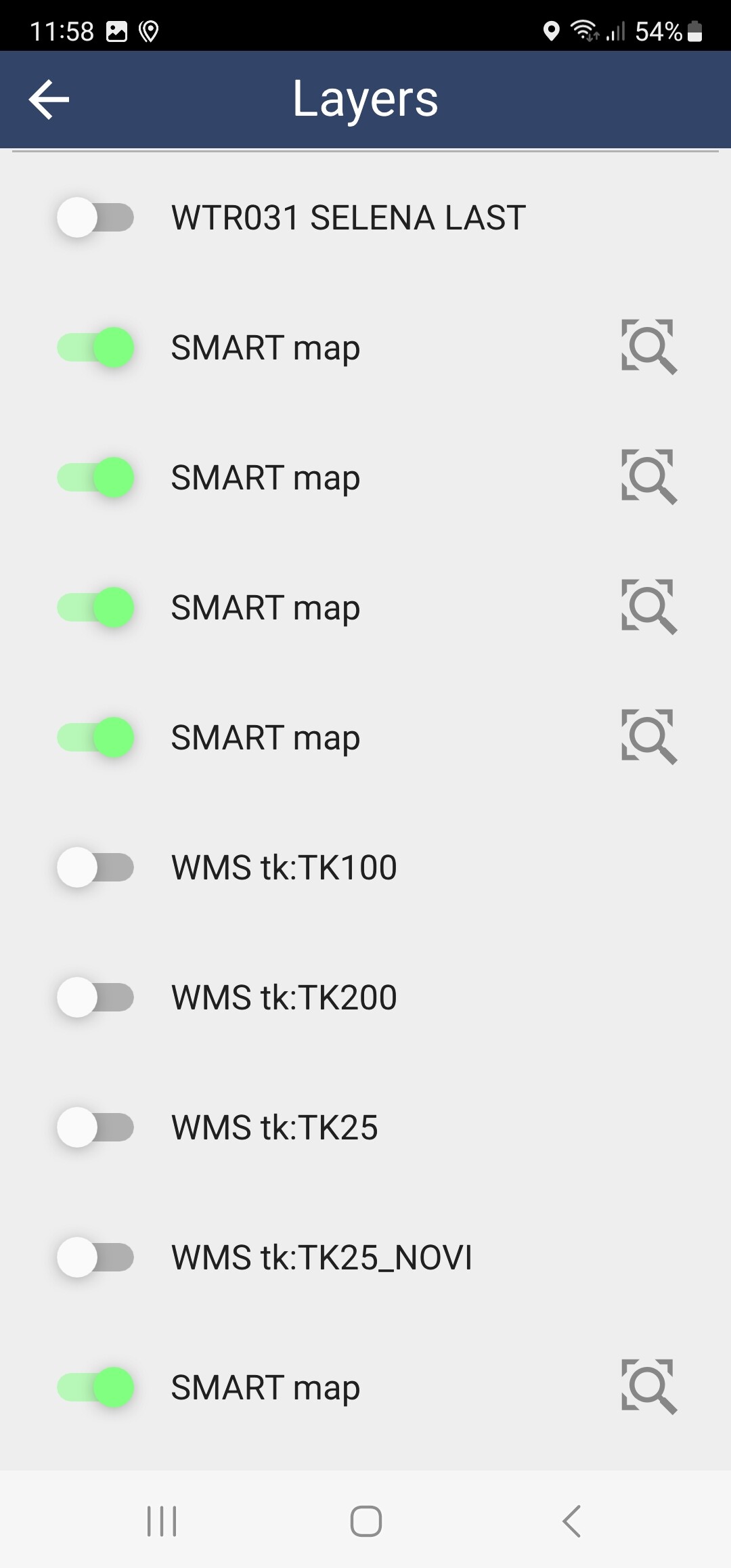
When having more than one SMART map, all such maps have the same name, which is “SMART map” and therefore they cannot be distinguished. This could be overcome by trying each of them and figure-out which one is needed. However, when one of SMART maps is turned ON, then all of then are turned on and vice versa. This applies to SMART maps from different CA as well as to maps of the same CA. Unwanted turning ON/OFF status of maps from different CA might not be a problem, they would not overlap, but this “just” might slow-down the mobile device, but could be a problem if those are maps of the same CA.
My question is if it would be possible to:
- Turn ON/OFF SMART maps individually?
- Give distinctive names to SMART maps?
- Change/adjust the transparency of offline maps at will form 0-100%?
- Possibility for picking offline maps from any folder and not only from “Download” folder
Thanks,
Josip
Thanks Justin, especially on the explanation where to find info about preparing offline maps!
Cheers!
Josip
Hi Josip,
I have submitted the enhancement request to allow distinctive naming of the offline SMART maps, and it will be evaluated for future SMART development. Thanks for the feedback!
Step-by-step!
Thanks Matt!
Hi all,
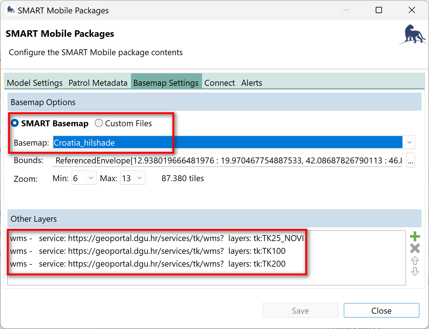
I noted some unexpected behaviour in mobile packages with offline maps defined in “Basemap Options” and maps from “Other layers”, while creating/updating package(s) in SMART Desktop 7.5.6 for SMART mobile, ver. 1.0.473. The things are:
- The defined WMS layers do not appear as map layers in SMART mobile 1.0.437. See screenshots of defined WMS layers and their absence in SMART Mobile (shown together with issue 2).
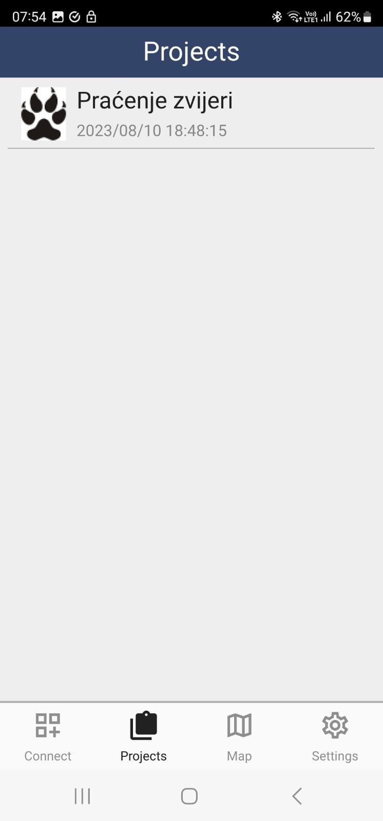
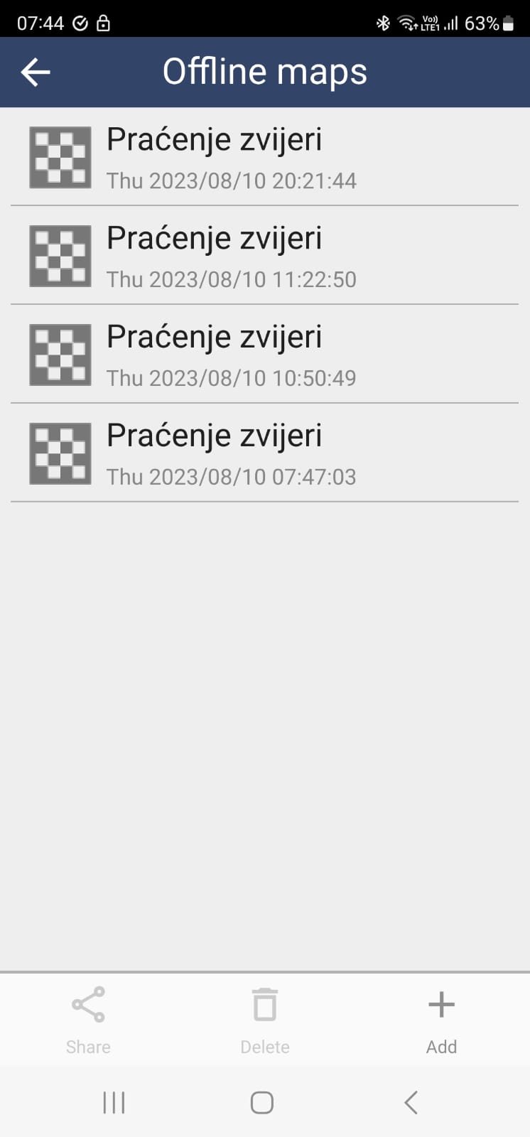
- Offline map created in SMART Desktop 7.5.6 appears multiple times, even if it is the very same map associated with just one package which gets re-created and uploaded to SMART Connect more than once. My guess is that each re-creation and upload of package containing offline map, results in another copy of the same map, even if the name of the map is the same. The expected behaviour would be that older map with the same name is overwritten. The following screenshot show that there is only one package installed (but updated several times), and that the same offline map appear four times. in the same time, there is no any WMS layer defined during the package creation, as explained under 1.
I deleted multiple instances of the same offline map and I did not check the functioning of On/Off slider when multiple maps with the same name exist as offline maps.
- This probably is for separate topic, but is still offline maps related.
The same offline map does not show identical layers at the same ZOOM levels.
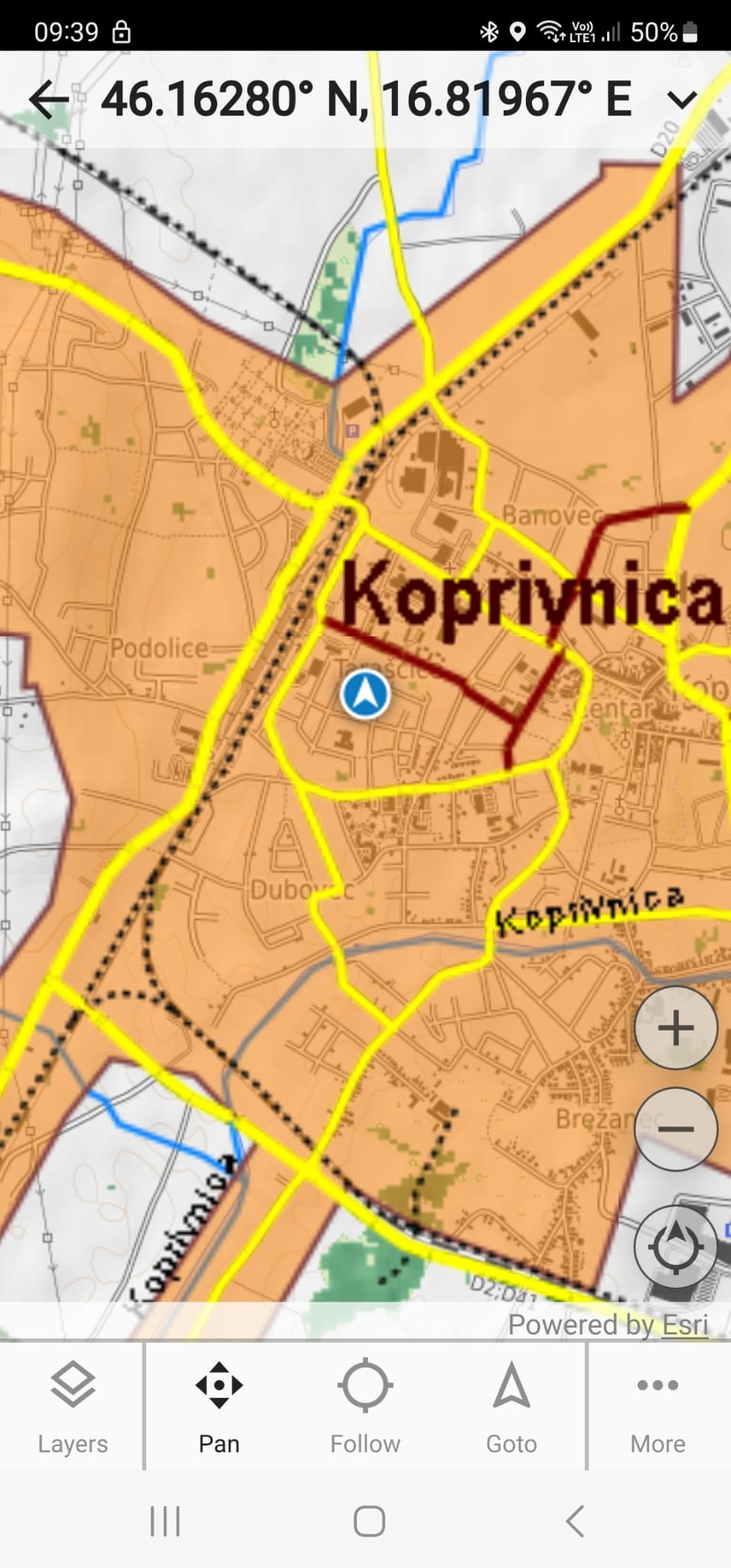
The offline map I created has roads layer with roads of different category. I defined on SMART Desktop → Change Style that roads of different categories are displayed at different ZOOM levels. On SMART Desktop roads appear and disappear as expected, depending on zoom level. When such map is included in mobile package, some roads (wider zoom) are displayed as expected, while those which are supposed to appear when zooming-in over the certain threshold (1:50000 in my case), they do not appear on SMART mobile. Here are screenshots illustrating the issue.
From Desktop
and from SMART Mobile ver. 1.0.473.
So, only yellow and red roads are displayed, while the minor roads (black lines) are not displayed, no matter how much I zoom-in.
Those are old/new issues. When compared with the need of retaining data on mobile, those are of secondary importance, but still rather relevant.
Greetings!
Josip
Hi Josip,
Note that the names might be the same, but they might be different anyway. Could you please retry without first deleting anything?
Otherwise, please send me a bug report.
Cheers,
-Justin
1 Like
Hi Josip,
Thank you, Justin.
Also, for the WMS can I confirm this source works in another WMS viewing platform and it is only SMART that cannot render it?
For the Zoom issue, the basemap is created in the SMART software, correct? In this case we may need to look into the desktop software or the layers themselves as this is likely not an issue with SMART Mobile.
Could you possibly share the basemap layers? Or again, can we check them in another platform before we come to the conclusion that it is a software issue? Thanks.
Kind regards,
Alex
Hi Alex,
Yes, it is possible to read WMS source with other GIS programs, in my case with ESRI ArcMap and ArcGIS Pro.
Yes, the basemap is created in SMART Desktop. The SMART Desktop displays the same basemap layers as defined in layer options.
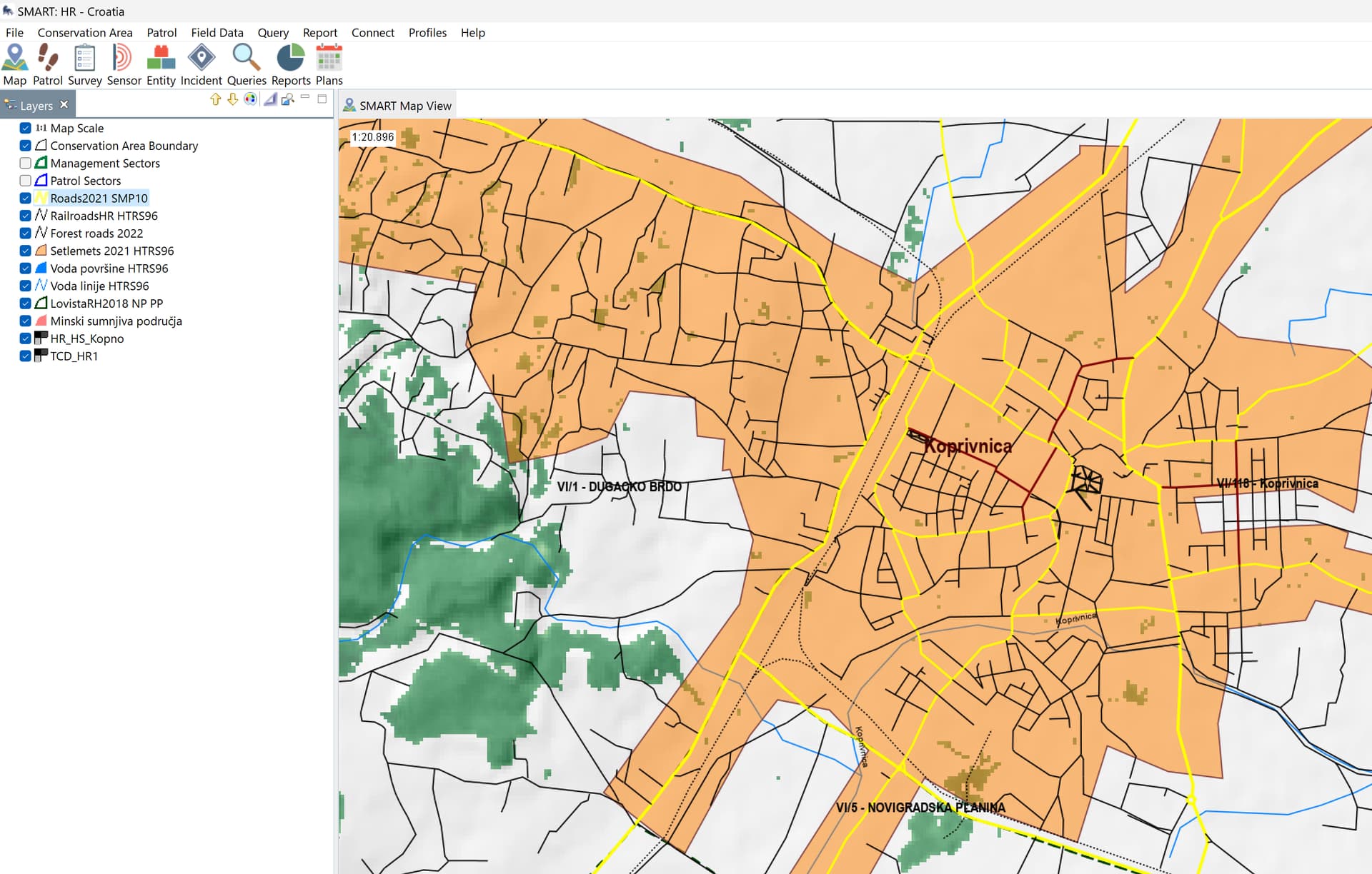
The problematic layer is roads layer (Dropbox - Roads2021.zip - Simplify your life)
It is rather large shp, it has 5-6 categories of roads, for which I defined different zoom level displays, i.e., on large zoom-our, only highways are displayed, but as zooming-in, more and more roads should become visible.
Interestingly, the very same road layer was displayed properly in some earlier version of SMART Mobile, as well as WMS sources were parsed as expected in some previous version of SM.
Greetings,
Josip
Hi Justin,
Well, I deleted all data associated with SMART mobile before reading your answer. Then I recreated and downloaded the same package with the same offline map few time. I can confirm that the same offline map does not appear several times after each upgrade/download to SM.
The absence of WMS layers and unproper zooming remained.
Cheers,
Josip
Hi Josip,
What is the URL for your WMS service?
Thanks!
Hi Josip,
I can look into the shapefile not rendering. It seems like an issue on the desktop side of things. Could you try clipping the layer to make it smaller? It may be the size causing the problem.
Cheers,
Alex
Hi Josip,
The issue is caused by a special character in the name of those layers. This is fixed in build 474, which is available now on the Android store.
Cheers,
-Justin
1 Like
Note that you will need to re-install any packages containing maps.
I tried with the build 474 of SM and it did not work for me. The mentioned WMS source just did not appear in the list of maps.
As usual, I have the latest version of Android, while the Desktop simulator is two steps behind with build number.
Best, Josip
You can always pick up the latest SMART desktop build from here: Download | CyberTracker Wiki
Could you please send me your mobile package zip file? Everything is working for me, so there must be something in your package that is not properly accounted for.
Thanks!
I do not see any WMS layers in this package. Could you try including a basemap before export in addition to the WMS layers?
Cheers,
-Justin